Rectification Project Levee Dam to Fabens, Topographic Survey
U.S. International Boundary Water Commission – El Paso County - TX
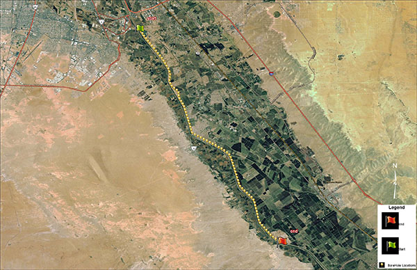
FXSA was retained by URS to perform professional surveying services for the Rectification Project Levee from Riverside Dam to Fabens. Our firm conducted alignment and topographic survey, including utilities, of approximately 15.8 miles of the border levee system from Riverside Dam to Fabens within El Paso County, TX. Data was collected using GPS and the VRS to provide state plane coordinates North American Datum of 1983 (NAD83). We were also responsible for conducting a topographic survey of the border fence and adjacent irrigation canal. We also recovered R.O.W. monumentation and report to the IBWC of any R.O.W. discrepancies.