
Continental Divide Scenic Trail, Boundary Survey
U.S. Bureau of Land Management – Grant County, NM
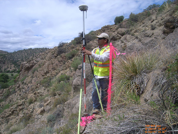
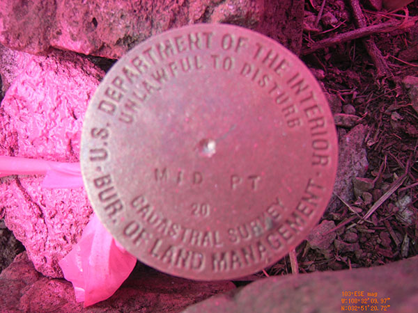
FXSA provided professional surveying services for the U.S. Bureau of Land Management under our current Cadastral Survey Services Contract. FXSA has been contracted to provide professional land surveying services in connection with the U.S. Forest Service’s proposed construction of approximately 2.5 miles of the Continental Divide Scenic Trail through portions of Grant County, New Mexico. The project consisted of research, retracement, survey and subdivision to the extent necessary to determine the boundaries between public and private ownership in sections 5 & 6, T 17 S, R 16 W and sections 27 & 34, T 16 S, R 16 W. FXSA staff performed GLO records research to secure original government surveys and any dependent resurveys of the sections effected and prepared field notes and plats depicting the result of the dependent resurvey, FXSA survey crews set monuments provided by the BLM at selected intervals along the centerline of the proposed Scenic Trail and at the boundaries between public and private owners. All survey work performed was in accordance with applicable sections of the 2009 Manual of Surveying Instructions for the Public Land Survey System.