WUI San Diego Cadastral Survey
USDA Forest Service Southwestern Region – Sandoval County, NM
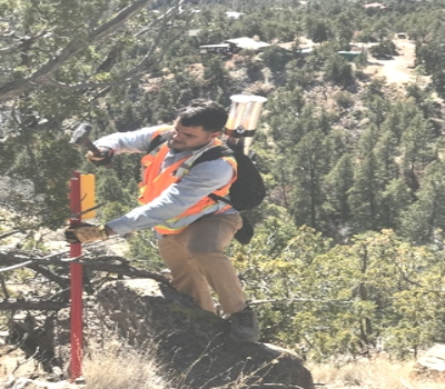
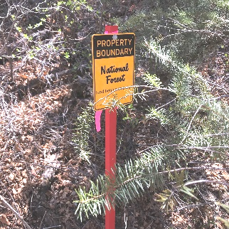
FXSA was awarded the WUI San Diego Cadastral Survey project in October 2017. Survey consisted of locating 5.04 miles of property line in T.18n. R.2 E, in Sections 1,11 and 12 within the Canon de San Diego Grant, Sandoval County, New Mexico. The boundary line in the project area is between Private and Santa Fe National Forest Land.
Prior to starting the project, the FXSA Team prepared a project and execution plan including all USDA Forest Service (FS) Southwestern Region requirements. This plan was prepared by the PLS Project Manager for our survey field crews, survey technicians, safety engineer, and QA/QC Manager. The first planning meeting held was with our survey field personnel to address the work to be performed. We then held a meeting with our survey technicians and QA/QC Manager. A third meeting was held with all members of the Team after they had reviewed the scope of work and project/execution plan to clarify the understanding of the scope & requirements by the FS, answer any questions and address any apparent conflicts. This planning approach proved to be our success in completing the project successfully and to the satisfaction of the FS.